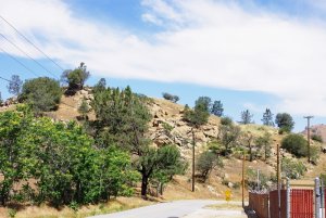
The scenery in eastern California and Nevada is dominated by "range and basin" geology, with ranges separated fairly widely by desert basins. However, vegetation and types of erosion also vary by climate and altitude. I hesitate to get too deeply into rock types -- I studied Geology 101 in college largely to help me with modeling, but the profs were always catching me up on dumb assumptions, and then I met several other geology profs in a club, and they pretty much wiped out what I thought I knew about rocks! However, here are some good rocks on Raton Pass, which are actually pretty similar to rocks you see north of Tehachapi:
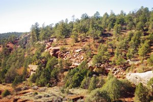
Trees also vary by altitude and climate. In California desert areas, like near Cajon and Tehachapi, you have mostly just chaparral on the lower slopes, but once you get to higher altitudes, you can see pines, especially in sheltered gullies. In California, what grows on the north slopes of what is called the Transverse Range (including San Bernardinos, San Gabriels, and Tehachapis) is much greener than on the south slope.
My own layout is a medium-large, about as long as Ken's is wide, so I have to be a little more selective and careful in what I try to portray. I would emphasize some regional and altitude/climate difference in scenery like that, especially to emphasize that the railroad is both climbing and going places.