
Beginning to plan layout in eanest, need ideas - part 1 background.

ModelRailroadForums.com is a free Model Railroad Discussion Forum and photo gallery. We cover all scales and sizes of model railroads. Online since 2002, it's one of the oldest and largest model railroad forums on the web. Whether you're a master model railroader or just getting started, you'll find something of interest here.


Iron Horseman

Well-Known Member
Beginning to plan model railroad pike in eanest, need ideas - part 1 background.

I have always said that doing a freelance is much harder than just modeling the prototype, so I've decided to cheat and do a protolance so at least 1/2 the work is done.

I am beginning to get serious about planning my model railroad. After years of deliberation and flip flopping of short line vs one road or the other, I keep coming back to the Colorado front range specifically the area about Pueblo. The cornerstone idea for the layout is to have the hanging bridge of the Arkansas River that is viewable from both the top of the Royal Gorge, as well as track side(river level). This should immediately let everyone know that there has to be a balcony 1000 scale feet (or 11.5 real feet) over that track. From that point eastward will be my model. The canyon will hide the entrance to the western staging area. The rest is up for debate at the moment.

As most of you also probably know the actual hanging bridge was built by the Canon City & San Juan Railroad during the battle for the gorge. Simultaneously, the Santa Fe was building east of Pueblo under the Pueblo & Arkansas Valley railroad name. Just a bit before this time the Union Pacific controlled Kansas Pacific under the name of Arkansas Valley Railway had built from Kit Carson Colorado SW into Los Animas, and then up river to La Junta Colorado. Parallel to that track from Los Animas to La Junta was the dreams of Pueblo business men the Pueblo & Salt Lake City. The route could not support one, let alone two, railroads. The UP withdrew and abandon the track (first non-mine or industry related trackage to be abandon in Colorado). The Pueblo & Arkansas Valley railroad acquired the bankrupt Pueblo & Salt Lake City. Later the Pueblo & Arkansas Valley acquired the Canon City & San Juan giving continuous line from the state line to the Royal Gorge. Unfortunately the end result of the legal battle of the gorge ended up giving the hanging bridge and rights to the Royal Gorge to the Denver & Rio Grande in the "Treaty of Boston". All of the above is real history.

In my railroad world the Treaty of Boston decision came out differently (fake history) such that either the Santa Fe won, or that both railroads had to share the trackage. Therefore, the question on the table is, "Where and how far would the Santa Fe main line have gone after it got through the Royal Gorge in both these scenarios?" Since this area is not going to be part of my layout why does it matter? Well, I am debating whether to model the Santa Fe 1st or 2nd district (or both) from the Kansas boarder to Pueblo. If the Santa Fe only gets to South Park and consequently Leadville, the 1st district will be very different than if they break through the Continental Divide and go straight to San Francisco or even NW to Portland or Seattle. So keeping in mind what the Colorado Midland, CB&Q, DSP&P, and the Moffat Route were doing in 1880, where would the "Pueblo & Arkansas River Valley" (my railroad) have been built to?
 
Last edited by a moderator:
While I am no where near as knowledgeable about the history as you are my laymans answer would be since its protolanced , I would go as far as you felt the area held interest for you . Are you going to tie in some narrow gauge ? I would assume it would include some mining interests? I don't know when steel came to Pueblo but that might be another consideration for you . How big is this layout going to be and how much compression will you do at the different industries. I have seen some of the designs you come up with for others and that makes me think that this will be an enjoyable thread to watch develop.
 
Are you going to tie in some narrow gauge?
During the time period I described above, all the D&RG would have been narrow gauge. In reality the hanging bridge was dual gauge until umm, I believe, 1911. As I bring it forward in time the narrow gauge retreated to the west, so no, I will not have any narrow gauge.

I don't know when steel came to Pueblo but that might be another consideration for you.
Yes, CF&I and its Colorado and Wyoming railroad is definitely on the table.

How big is this layout going to be and how much compression will you do at the different industries.
Haven't decided yet. Originally it was to be two levels in a normal basketball court gym 105'x70'x30'. Things happened and on one hand I'm afraid that is just too much space, plus we fell in love the the gym and want to keep it as is. On the other hand, that size is one reason why I decided not to model the Louisville and Wadley shortline. The whole railroad is only 10 miles long and would not have filled the space. So now the idea is to plan the railroad first and then I'll find a home for it and do as much or little compression as is necessary.


That is an unbelievable amount of room to have available . I could see where it could actually create some problems . You could work and work and even though you knew you made progress it could very well not show. How many people are going to be working on this layout ? What you might consider with the possible size you could achieve here is that you start your layout at the bridge and go both ways , say to the first town each way and work like that , never really having a definition of "the end" . That way the task would not be so daunting and as you progress with construction you will still be able to operate if you want. That might also help with variables like help and finances . Just trying to throw out some different ideas for you.
 
T What you might consider with the possible size you could achieve here is that you start your layout at the bridge and go both ways , say to the first town each way and work like that , never really having a definition of "the end" . .... Just trying to throw out some different ideas for you.
While I appreciate the thought, that is the opposite of what I want to do. I will determine the end before a spike goes to rail.

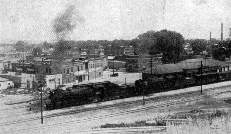
The first town to the east is Canon City. I don't know if I will include that or not. Next real town is Florence then the Portland Cement plant. Florence holds a special consideration as it is three generations of my family home, even though there isn't really a lot there other than a really nice station. Photo below is Florence Colorado Looking north and a bit east at the station. The curved track in the lower part of the photo is the Santa Fe branch south to Coal Creek. One of several mines in the area.
florence%20depot%20yard%20train%201926%20d2-11.jpg
 
Last edited by a moderator:
Quite an ambitious plan. I really like "what if" railroads. What could have happened if back in history different decisions had been made. This is sort of along what my freelance railroad is, but on a much grander scale.

I too chose to model the area right where I live as I am very familiar with the industries that were in the area at the time and what industries could have evolved if an unknown entity had stepped in. At one time I had thought about a large empire with a large city or two that would possibly permit many different operating possibilities but did chose to build a small railroad serving small towns (all of mine are real towns in my area). Instead of a long main line running around the room numerous times, I chose to have a single track main line which gave me more space for industries and and town to detail.

Way back when, I had an N scale layout with over 11 scale miles of main line but after moving to HO scale and having the ability to add more detail I am really happy that I chose what I did. It sounds very similar to what you are talking about and I am looking forward to see what you come up with. I did unfortunately compress space as we were using most of out basement at the time having kids growing up. I had been given the green light to expand and take over the entire basement if I wanted, but at my age, I don't know how much I could get done.

Having the room you are talking about, your plan sound excellent. You could model small communities and local industries and still have generous amounts of space to separate towns and have long distances between towns.

I had spent a lot of time in the planning stages while benchwork was going up and trying to find a purpose for my railroad. For me, it worked out well except for the lack of hobby supplies where I live. Thankfully we now have online retailers. I figure that I probably lost from six to ten years of work on may layout because of this.

I believe that you are doing the right thing by taking your time and planning. We didn't have the internet back when I started my layout, but we did use USGS maps working out where was the most probably route for the railroad. Now with Google Earth and other online resources, you have the world at your finger tips.

I am wishing you good luck and I will be very interested in what you come up with.
 
have you done a Google search for someone's plan that is based on or includes your RR?
While I am not even close to looking for a track plan yet, Dick Vogler has done a small layout based on the concept of bringing the P&AV forward in time. http://www.pcmrc.org/pav.html. The huge difference is his railroad is unprototypically owned by the D&RG but the end of the line is Canon City like the prototype. We know exactly what the D&RGW did on the other side of the gorge after 1879. On the other hand, my road is prototypically owned by the Santa Fe but will unprototypically continue to go through the gorge. This is an exercise in making educated guesses as to what the Santa Fe would have done after 1879. Hence my line might be carrying the bulk of the transcontinental trains like the California Limited and San Francisco Chief rather than sending them south through the Raton. How about a Las Vegas Chief, Reno Chief, or a Portland Chief?
 
Last edited by a moderator:
Have you chosen a time period that you are interested in? One thing going for you is that it is your layout and by freelancing, or proto freelancing, you can really do anything you want.

Looking at his track plan, I am a big fan of all the switching that is possible on the layout. A lot of track! I almost fell into a similar situation but down scaled because I am the only person that would operating it and having to maintain it.
 
Have you chosen a time period that you are interested in? One thing going for you is that it is your layout and by freelancing, or proto freelancing, you can really do anything you want.
Yes, I'm going for about a decade after WWII so 1947 to 1956. That is the period most of my existing the equipment is for. Depending how in depth I do Pueblo, I might stretch that out into the early 1960's so I can use all the GN - NP equipment that the C&S had on lease and used there at that time. GN and NP are the 2nd and 3rd most represented roads in my current equipment roster. In fact I might have more GN and NP box cars than I do Santa Fe & D&RGW. But doing that I would have to give up my Steam engines. Don't think I want to go that far.

I really thought about doing the very end of the war so I could get all the war traffic at Granada CO. It is the first real town east of Lamar on the 1st division. My uncle owned farms along the right of way. It was there I saw many of the trains roll by, and remember going out in the 1960s and playing amidst the buildings of the abandon internment camp. But that is too big a compromise with the roster I have.

But to your other point, no, I dislike model railroads I've seen designed with the "do any thing I want" philosophy. My goal is a V&O type model railroad. It has to be so good and believable that it is hard to tell it is fiction. Selectively compressed - absolutely; gaps in the geography - yes; variations for modeling operations - yes; stuff like just running a branch of the GN down through the wind river mountains to connect to - no.
 
Last edited by a moderator:


I built the history of my railroad the way your doing yours. The result could fool someone who was ignorant of the real local history. My story is less of a stretch as it runs through rolling hills instead of the Rockies. Is there a reasonable route through the area that wasn't used? I don't know the topography. How much local industry was there in that area? How far are you from Moffets tunnel? I think it was Trains™ that showed his system in an article. You could have your railroad meet at that point and either have a friendly connection or have the Moffet Road bought up by Santa Fe instead of UP.

Sent from my XT1080 using Tapatalk
 
I built the history of my railroad the way your doing yours. The result could fool someone who was ignorant of the real local history. My story is less of a stretch as it runs through rolling hills instead of the Rockies. Is there a reasonable route through the area that wasn't used? I don't know the topography. How much local industry was there in that area? How far are you from Moffets tunnel? I think it was Trains™ that showed his system in an article. You could have your railroad meet at that point and either have a friendly connection or have the Moffet Road bought up by Santa Fe instead of UP.
Thanks for your post, it made me go back and look at exactly what the Moffat road was doing in 1880. The answer is nothing. The Denver, Northwestern and Pacific Railway was not incorporated until 1902. So that actually takes them off the table, making Rollins pass up for grabs. But, since the Santa Fe is already through the front range that would not be a consideration. Hmm, apparently the Colorado Midland was also non-existent at the time being incorporated in 1883. I had no idea they were such late comers to the game.

The DSP&P was already over Kenosha pass to Como and headed up Chalk Creek to the Alpine Tunnel.

Seems the choices are to head for Leadville (as the D&RG did), try to go straight through Monarch pass, go south to the Gunnison river and Marshal Pass (also as the D&RG did), Haggerman Pass (or whatever they called it back then), angle way south to the Dolores river. Then also perhaps the steeper lesser known passes like Cottonwood?
 
Last edited by a moderator:
See my videos in N Scale, I had Georgetown in mind, but thought about Durango, Steamboat Springs, Idaho Springs, etc. It's somewhat close, but my first ever layout.

Sent from my XT1254 using Tapatalk
 
Having spent a "few" hours looking at topo maps and surveys of the continental divide, I think I've found a route. The link below is Fosses Creek Valley. Follow it up to the 10,000 foot level, then a 4.5 mile tunnel under Monarch Pass, comes out at the 9,600 foot level in the Porhyry Creek canyon, follow that to the Black Sage Pass into Wanunita Park and down Quartz Creek. From there to Parlin CO where the railroad should meet up with the DSP&P railroad coming from the north, and the D&RGW coming from the south.

From the Tunnel Engineering Handbook by Kussle - "If possible max grade in straight tunnel should not exceed 75% of the ruling grade of the line. This grade should extend about 3000ft before and 1000ft beyond the tunnel".

The proposed tunnel would have a 1.6% grade, which is good for the 2% approach slope. The only thing I don't like about this, is the slope is going down from east to west. Most RR tunnels under the divide are sloped the other way, so they can also move water from the west slope to the east. The only way I see to remedy this would be to take the previous canyon for Willow Creek toward Peck Mountain, but then the tunnel would have to be more like 6.5 miles. Not unheard of but.....

https://goo.gl/maps/KTYmfZnTWJr
data=!3m6!1e1!3m4!1sasFWkCT99V2dzFF122VRVw!2e0!7i13312!8i6656
 
Last edited by a moderator:
I think this phrase is the key " Most RR tunnels ". If there are other reasons that ,combined with the slope direction, that may cause an operations impact then you might want to rethink it , but if that were the only reason and going that way made things easier/no difference , then I would not let it carry a ton of weight in the decision process .
 
Wow! You guys are talking "big time" layouts. Can't imagine the work ahead of you. My little N Scale Layout 66"x42" turned out really nice, but still took 5 and half months and still have a little more to do. 3 months just for layout research, theme, etc before that. Would enjoy seeing your progress updates as you build. Good luck.

Sent from my XT1254 using Tapatalk
 
I really like what you are doing in your planning process.

When I was planning my layout which was also connecting with another modelers railroad, we used what we had available. There was no Google earth at the time, but we did use USGS maps and being that we were going to model the area that we live in, I got some flying time in also flying over the actual area to try to find the most suitable route that a railroad could follow. It is amazing how much time one can put into researching something like this, but I did find it quite interesting.

I have been following you post and absolutely will continue to see what you finally come up with . Looking forward to updated.

Well done.


When I was planning my layout which was also connecting with another modelers railroad, we used what we had available. There was no Google earth at the time, but we did use USGS maps and being that we were going to model the area.
Actually I only used Google to identify the general area. Then I switched to USGS map of that place to do the engineering.


Affiliate Disclosure: We may receive a commision from some of the links and ads shown on this website (Learn More Here)

Back
Top
