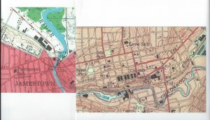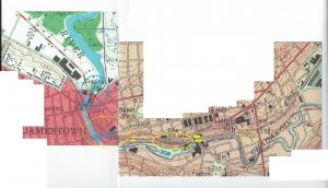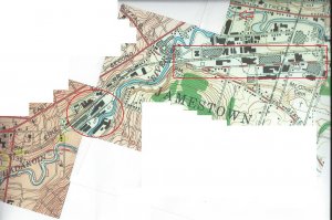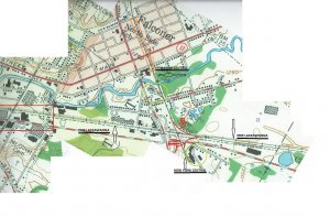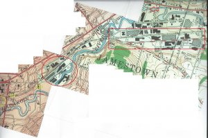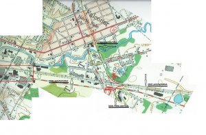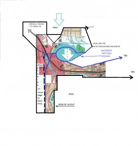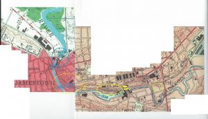
This is the western-most portion of the Jamestown area...there's very little to consider farther west (southwest, actually) until one gets to Corry, PA where the EL interchanges w/ the PRR.
From l. to r.:
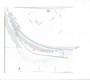
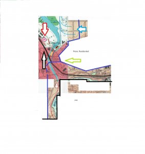
Blue Circle (bc)- 'Gaging Station'...there's a dead end track serving the gaging station, the parallel track running north is the old Chautauqua Lake Railway line. The 'V' shaped building (just outside the bc) are the offices of a scrap metal yard located behind (north) of the bldg. that had a yellow painted crane w/ magnet. There were several small 'machine shops' farther north...served by the depicted trailing point spurs. Next to the gaging station is the 'barely there' Fairmount-Jones & Gifford bridge (we called it the "boat landing bridge"). At the bottom of (within) the bc is the old Jamestown Traction Co. machine/repair shop.
Blue Parallel Lines at the Blue Circle- this is the 6th.St. Bridge which is about 30' above the rail grade below. It begs to be where I put a backdrop but then what do I do with the Gaging Station, scrap yard, and machine shop spurs which would end up being on the 'wrong' side of the backdrop? Leave them off, move them to the forefront of the backdrop, leave them on the other side of the backdrop?
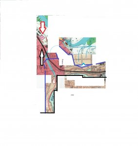
Left Yellow Circle - The 3rd.St. Bridge (two parallel lines w/in yellow circle) is about 40-50' above the rail grade. It would be a better backdrop than the 6th.St. bridge location if it weren't for the fact it runs right over the western yard. Built in 1922 I can't pretend it wasn't there in 1963, can I? I'm not sure what to do about it.
From this west yard runs a spur across the Chadakoin River to the BPU electric plant and lumber yard farther on. I'm already thinking I'll have to rotate this spur clockwise 90 degrees so the layout aisle is "in" the river. That would put the spur perpendicular to the yard, in the foreground, and the electric plant against the backdrop (can cut the electric plant model in half to save space).
Thin Yellow Parallel Lines (to r. of Left Yellow Circle) - I think this rail overpass is actually two rail bridges (with W.2nd.St. passing below and south over the river). The concrete retaining wall and steep road grade would make a good backdrop boundary following 2nd. St. eastward past the Erie RR terminal (Right Yellow Circle).
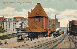
Right Yellow Circle - This is the Erie Station and pax platform location next to east yard. Fortunately, the Washington St. bridge over this area hasn't been built yet. If anything, I think this yard would be the one I'd want to scale-out as much as possible, maybe, though I like the curve of the west yard.
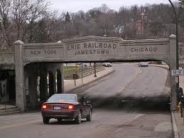
Two Thick Parallel Yellow Lines (r. of Right Yellow Circle)- Just pointing out the location of the concrete "Erie Railroad: New York - Chicago" overpass that's popularly shown on the internet.
Light Green Circle - just a couple spurs to remember...in case there's room and inclination to depict them on the layout. I have to see if they served a business I want to depict...forget what was there.
